

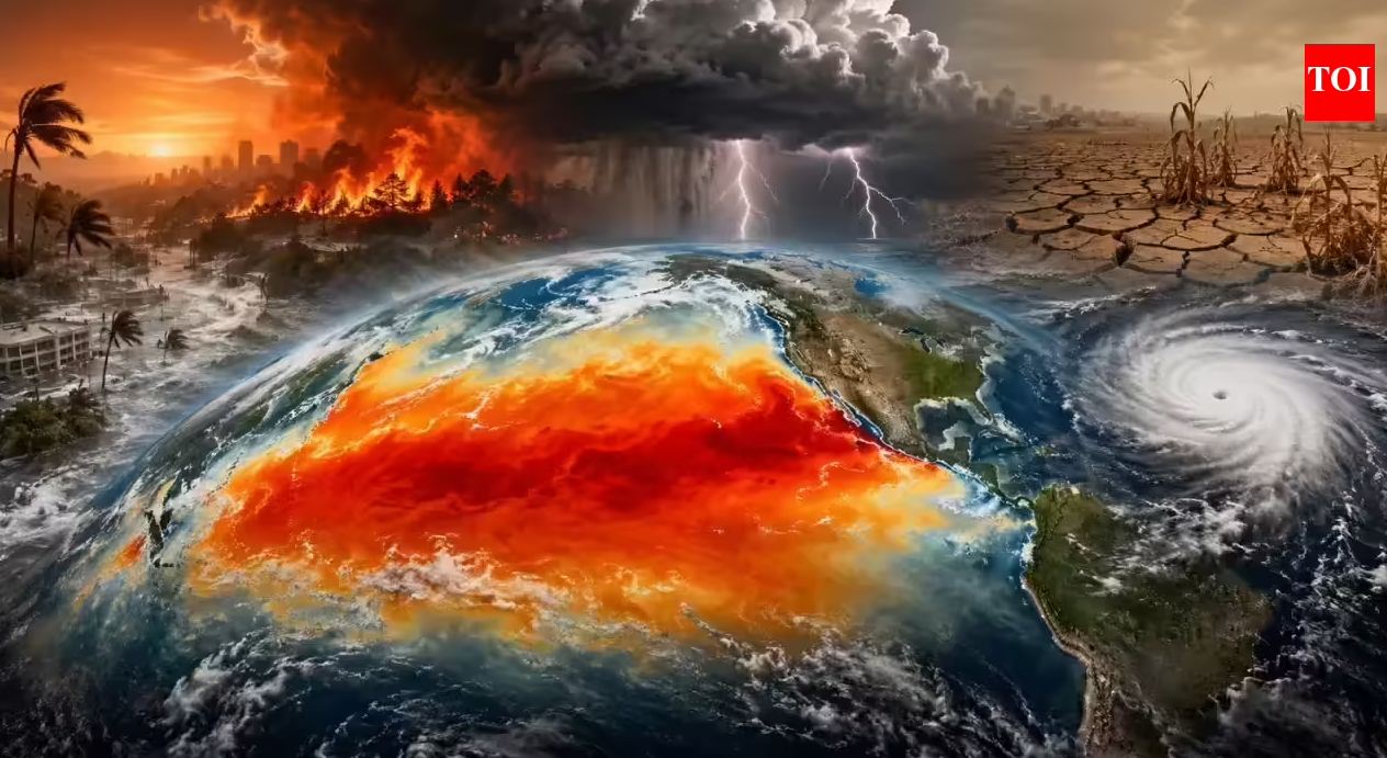
Climate experts are warning that a rare and potentially historic “Super El Niño” may be forming in the Pacific Ocean, raising concerns about dangerous weather patterns, record-breaking heat, flooding, droughts, and powerful storms across the globe. New forecasts suggest the phenomenon could become one of the strongest El Niño events ever recorded.
Meteorologists say ocean temperatures in the tropical Pacific are rising faster than expected, increasing the chances that the weather system could intensify rapidly later this year and continue into 2027. According to recent forecasts from the National Oceanic and Atmospheric Administration, there is now a very high probability that El Niño conditions will officially develop in the coming months.
What Is El Niño?
El Niño is a naturally occurring climate pattern caused by unusually warm ocean water in the central and eastern Pacific Ocean. The event disrupts normal wind and rainfall patterns around the world and can dramatically alter weather conditions across multiple continents. Normally, trade winds push warm water toward Asia and Australia while colder water rises near South America. During El Niño, those winds weaken or reverse, allowing warm water to spread eastward across the Pacific. This shift changes atmospheric circulation worldwide and can affect temperatures, rainfall, storm development, agriculture, and even food supplies in many countries.
Why Experts Are Concerned
Scientists say this particular event has the potential to become a “Super El Niño,” a term used for especially powerful El Niño events that create severe global consequences. Forecast models are showing ocean temperature anomalies that could rival or exceed previous historic events. The last major Super El Niño in 1997 and 1998 caused devastating floods, droughts, wildfires, and storms across the world. Reports estimate that tens of thousands of people died and billions of dollars in damage were recorded during that period. Experts fear a modern version could be even worse because global temperatures are already significantly warmer due to climate change. Additional heat from El Niño could push parts of the world into record-breaking temperature territory.
Possible Impacts Across the World
Weather agencies warn that a strong El Niño could trigger very different impacts depending on the region. Some areas may experience extreme rainfall and flooding, while others could face severe droughts and dangerous heatwaves. Scientists are also warning about increased wildfire risks in dry regions. In the United States, forecasters believe parts of the South and West Coast could see wetter conditions and stronger storm systems, while northern regions may experience milder winters. Australia and parts of Southeast Asia often experience hotter and drier weather during strong El Niño periods, increasing concerns about bushfires and water shortages. South America may face intense rainfall and coastal flooding.
Could It Become the Strongest Ever?
Some meteorologists believe the developing system could become one of the most intense El Niño events in recorded history if warming continues at its current pace. Forecast models have shown increasingly stronger projections with each update over recent months. However, scientists also caution that long-range climate forecasting remains difficult, and the exact strength of the event will depend on how ocean and atmospheric conditions evolve later in the year. Even so, climate organizations around the world are closely monitoring the Pacific Ocean as preparations begin for the possibility of severe weather disruptions in the months ahead.


")


