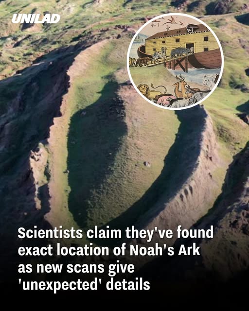
Recent ground-penetrating radar (GPR) scans at the Durupinar site in eastern Turkey have unveiled compelling evidence suggesting the presence of a man-made structure beneath the surface. This boat-shaped formation, measuring approximately 538 feet in length, aligns with the biblical dimensions of Noah’s Ark as described in Genesis. The findings have reignited debates about the historical veracity of the Noah’s Ark narrative and the potential for archaeological validation.
Discoveries at the Durupinar Formation
The Durupinar site, located about 18 miles south of Mount Ararat, has long intrigued researchers due to its distinct shape and size. The latest GPR scans conducted by the team from Noah’s Ark Scans have revealed a 13-foot tunnel running through the center of the formation, along with three distinct subterranean layers. These features correspond with the biblical account of the Ark having multiple decks. Additionally, angular structures approximately 20 feet below the surface have been detected, which some researchers interpret as potential living quarters or storage areas within the vessel.

Soil Analysis and Organic Indicators
Complementing the radar findings, soil analyses have indicated anomalies within the formation. The soil inside the structure exhibits lower pH levels, higher potassium content, and increased organic matter compared to the surrounding area. These characteristics are consistent with the decomposition of wooden materials, suggesting the possible presence of a decayed wooden structure. Furthermore, the grass growing within the formation differs in color from that outside, potentially indicating variations in soil composition due to underlying materials.
Historical Context and Previous Research
The Durupinar formation was first brought to attention in 1951 by Turkish Army Captain Ilhan Durupinar during a NATO mapping mission. Since then, it has been the subject of various studies aiming to determine its origins. While some researchers have posited that the formation is a natural geological structure, others argue for its man-made origins based on its shape, size, and internal features. The recent findings add to the body of evidence suggesting human activity in the region during the Chalcolithic period, approximately 5500 to 3000 BC, which aligns with the proposed timeline of the biblical flood.
Skepticism and Alternative Explanations
Despite the intriguing data, some geologists and archaeologists remain skeptical. Critics argue that the formation’s features can be explained by natural geological processes, such as mudflows and fault lines. They caution against drawing definitive conclusions without more extensive evidence and emphasize the need for rigorous scientific analysis to substantiate claims of the Ark’s discovery.
Future Research and Exploration
The research team plans to conduct core drilling at the site to obtain direct samples from the subsurface layers. This step aims to provide more concrete evidence regarding the formation’s origins and to determine whether the internal structures are consistent with human construction. The team also intends to collaborate with Turkish universities to ensure that the investigations adhere to scientific standards and preservation protocols.

Conclusion
While the recent radar scans and soil analyses at the Durupinar site offer compelling evidence that aligns with the biblical description of Noah’s Ark, the findings are not yet conclusive. Further interdisciplinary research, including core drilling and comprehensive geological studies, is necessary to validate these claims. The ongoing exploration continues to captivate both the scientific community and the public, keeping the centuries-old quest for Noah’s Ark alive.


